Hikes and walking Trails within 30 minutes of Brisbane

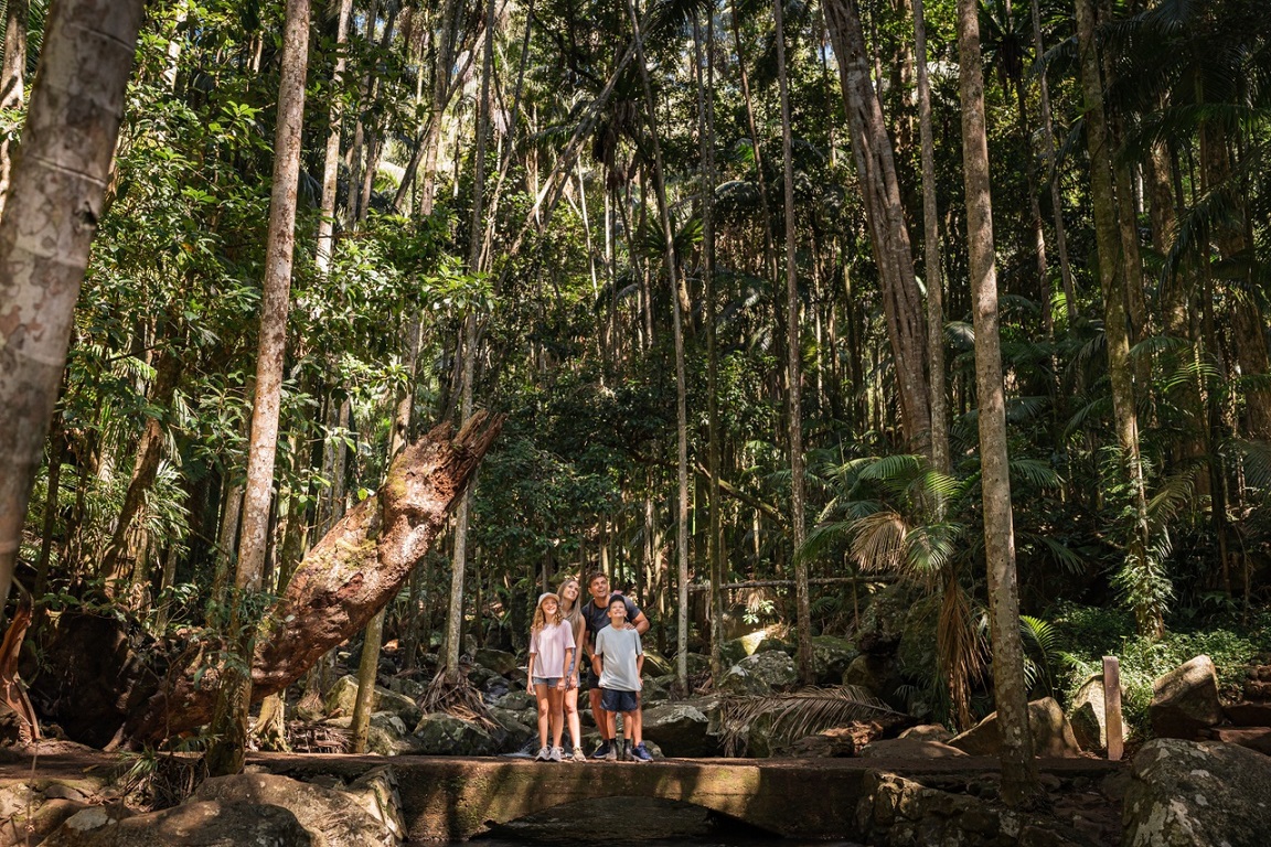
There’s no need to travel far if you’re searching for a little bit of adventure in Brisbane. Lace up your walking shoes and hit the road, you’ll be surprised and delighted by how many bushwalking and hiking trails fall within a 30-minute drive of The City.
North
Summit Track, Mount Coot-tha
Just a 15-minute drive from The City, you can enjoy 1500ha of natural parkland and open eucalypt forest at Mount Coot-tha. Along the bottom of the hill lies the Brisbane Botanic Gardens and Planetarium, while at the top, you’ll find the popular lookout that captures the whole of Brisbane City. Walk the 1.9km Summit Track from the JC Slaughter Falls picnic area to the lookout in just 30 minutes. Alternatively, trek the 2.1km Honeyeater Track or join the short Simpsons Falls and Eugenia Circuit to create a 4km, 90-minute trek.
Walking difficulty - Easy
Holmans Break, Walkabout Creek
Keep an eye out for goannas, various birds and turtles tanning near the dam on this 12.7km trek through Enoggera Reservoir. The five hour journey starts at the bottom car park at Walkabout Creek, taking a small track to the far right that follows Mount Nebo Road. After 2km the track will split, stay right and you will come to a clearing with an incredible view out over The Gap.
Walking difficulty - Moderate
Morelia walking track, Mount Nebo, D’Aguilar National Park
Trek through the eucalypt forest leaving from Manorina on the Morelia walking trail. Keep an eye out for the cabbage tree palms, recognisable by their huge, fan-shaped leaves,on the 6km walk. At the end you’ll hit the Mount Nebo Lookout with stunning views over the Samford Valley and out to Moreton Bay..
Found 1.5km north of Manotina - leaving from the Mount Nebo Transfer Station, the Cabbage Tree Range Loop is an epic 17km hike that will take about four to seven hours for those seeking something more challenging!
Walking difficulty - Hard
Mermaid Mountain, Brisbane Forest Park
After a lengthy challenge? Trek from the town of Mount Crosby up Mermaid Mountain on an epic 13.2km hike. About halfway you’ll be treated to a great view of Lake Manchester and surrounding hills..
Walking difficulty – Hard
Gold Creek Reservoir, Upper Brookfield
This iconic two-hour trail surrounds the old Gold Creek Reservoir is found in Upper Brookfield. Walk along the top of the dam and onto what was Queensland’s first built spillway the more adventurous hikers can trek the 5.5km dam circumference.
Walking difficulty - Moderate
Araucaria Track, Brisbane Forest Park
This super easy 5km walk takes just 90 minutes to complete and is perfect for the whole family. Take a camera and binoculars as you may spot a wide range of birds such as bellbirds and whipbirds along with plenty of other wildlife. You can combine this walk with the Corymbia Circuit to stretch it out a little further.
Walking difficulty - Easy
D’Aguilar trails and hikes
Boondall Wetlands Bikeway, Boondall Wetlands
Visit 1500ha of tidal flats, mangroves, salt marshes, melaleuca wetlands, grasslands and open forest in Brisbane’s largest wetlands area. Getting around is easy with the help of boardwalks and bitumen pathways. The 13km bikeway takes three hours to walk, passing by the Anne Beasley Lookout. Stop by the Boondall Wetlands Environment Centre for displays, facts and help planning your visit.
Walking difficulty - Easy
Bunyaville Track, Bunyaville Regional Park
Just 15km north-west of The City, Bunyaville is a top spot for walking, horse riding and cycling. Two walking tracks can be accessed from the day use area, the longer Bunyaville Track is just a 2.9km loop and takes only 30 minutes.
Walking difficulty - Easy
West
Devils Break Loop, Moggill Regional Park
Part of a bushland corridor that stretches north as the D’Aguilar Range, Moggill Conservation Park is 500ha of unspoilt wilderness to explore. Park the car at the end of Chalcot Road and begin your 6km return walk. The park is well signed, and the Devils Break Loop will take about two hours..
Walking difficulty - Easy
Lake Manchester Loop, Lake Manchester
Located 25km west of Brisbane, the Lake Manchester walk is a hilly 17km clockwise loop, which begins at the day use area up past the dam wall and follows the lake edge before heading up into the hills. Bring plenty of water, there are a few creek crossings, but most will be dry. For those looking to stay overnight, you can book a campsite at the Blue Gum Flat, which you stumble across part way along the loop.
Walking difficulty - Hard
South
Poets Rock, Karawatha Forest
Pack your pen and notebook when you hit the trail for Poets Rock inside the 1000ha Karawatha Forest. This 13km journey takes about hours and the top of the rock is a great place to think and write.
Walking difficulty - Moderate
Buhot Creek Circuit, Daisy Hill Conservation Park
Starting from the upper day use area, this 9km walk should take about three hours. Make sure to wear a pair of decent shoes as it may be a little rocky and keep your ears peeled for oncoming cyclists as you ponder through this beautiful conservation park.
Walking difficulty - Moderate
Venman Circuit, Venman Bushland National Park
Wander along the scenic banks of Tingalpa Creek via melaleuca swamp and open eucalypt forest on this trail. Allow 2.5 hours to complete this 7km circuit through the national park, and add time if you’d like to join it to one of other trails in the Koala Bushland Conservation network of parks.
Walking difficulty - Easy
Stockyard Creek walking track, Brisbane Koala Bushlands
Keep an eye out for koalas – they aren’t always easy to spot in the wild. A network of nearby parks has formed to create a safe haven for these favourite native animals and the 1.4km Stockyard Creek track gives you a one hour loop to wander through open eucalypt forest. Those wanting a longer walk can join the 5.4km horse trail.
Walking difficulty - Easy
Federation Track, Mount Gravatt
Trek from the base of Mount Gravatt to the summit on this 3km round trip. The Federation Track is one of the most popular routes up the hill that will take you just over an hour to complete. When you reach the top, be prepared to find rolling views of Brisbane City and surrounds.
Walking difficulty - Easy
Please note, this article is intended as inspiration only. Before heading out, be sure to research current walking conditions and weather conditions.